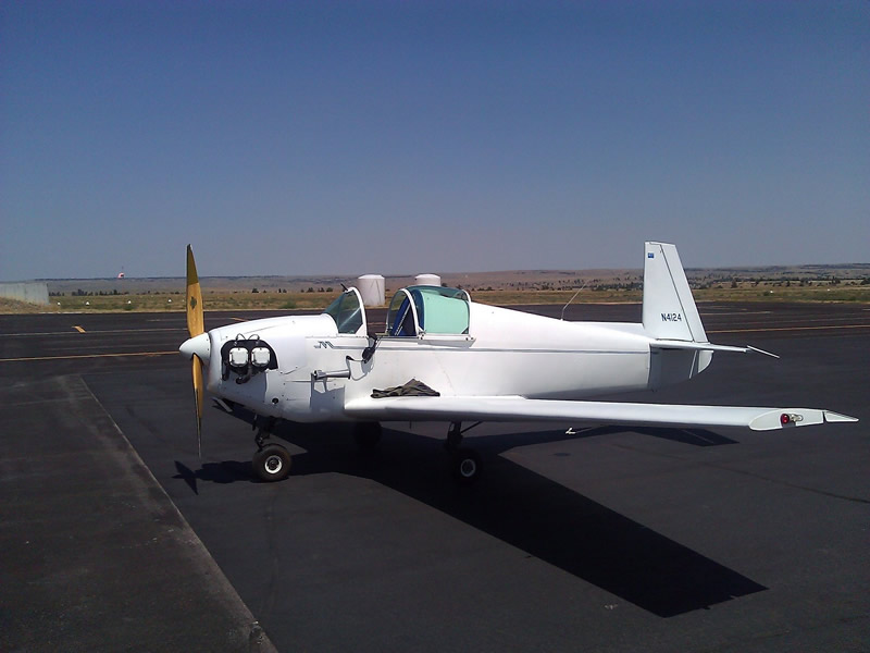
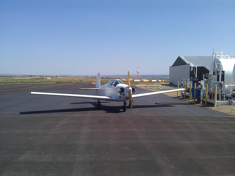
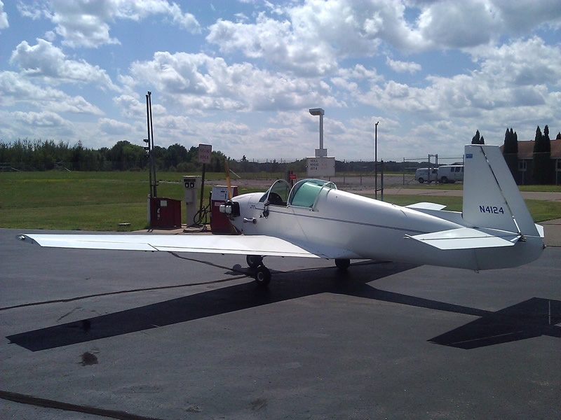
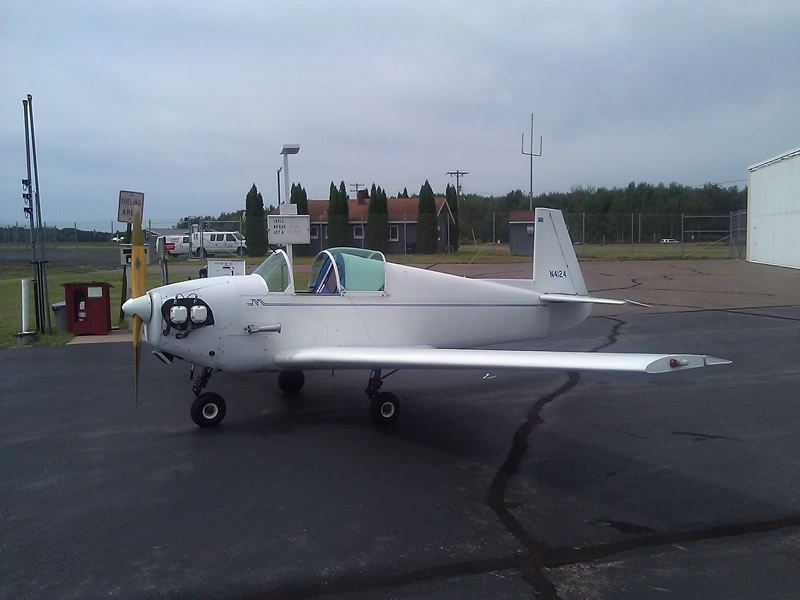
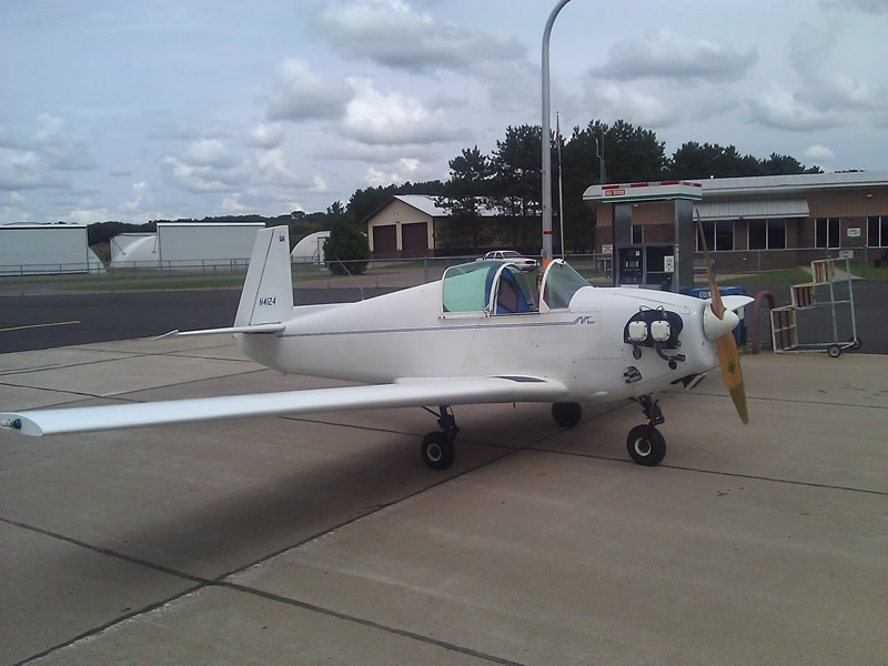
Joel Johnston Flies N4124
From Washington to Michigan and Back
From an email exchange:
Hey Dave –
Thought I’d let you know I plan on leaving Deer Park Tuesday or Wednesday next week in N4124 for the annual migration to Michigan for two weeks’ vacation. Right now I’m planning to overnight in Wahpeton, ND (just south of Fargo), visit an old family friend in Eau Claire, WI on Day 2 and hopefully turn the corner at the Macinaw Bridge and head south to St. Helen where my Dad has his hangar at the end of Day 2. It should be about 8 hours of flying each day.I have your e-mail address plugged into my Windows Phone and will try to remember to shoot some pics over the nose and off the wing and send them directly to you.
Hey Joel,
Thanks! I always appreciate receiving a flight report and photos. I'll put them on the Site.
By "send them directly" do you mean from your phone as you are flying?! Now that would be neat. Have a good flight to Michigan. I envy you!I'm looking forward to more photos. Some including yourselves would be nice, too. You'll remember to tell me the What, When and Where when you send them….
Cheers!
Dave.Not sure if I’ll send “while I’m flying” (need to attend to the task at hand and “Fly the Airplane First!”) but I can certainly shoot them off at a fuel stop when I’m safely on the ground. Will try to provide detail as required. A nice shot of Lake Michigan and the Mackinaw Bridge would be nice highlights. Eastern Montana is less exciting. Weather is forecast to be sunny and downright hot along most of the route.
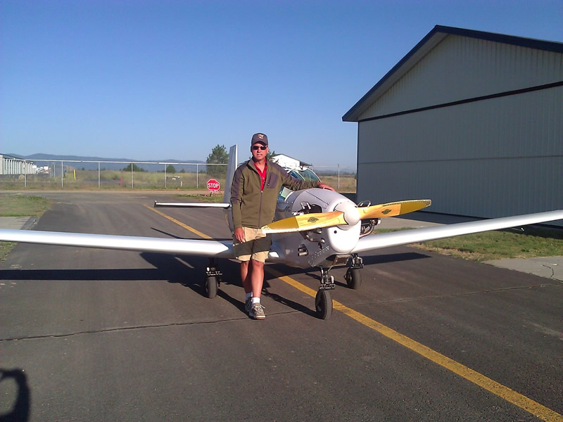
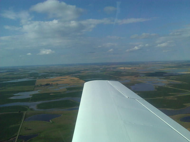
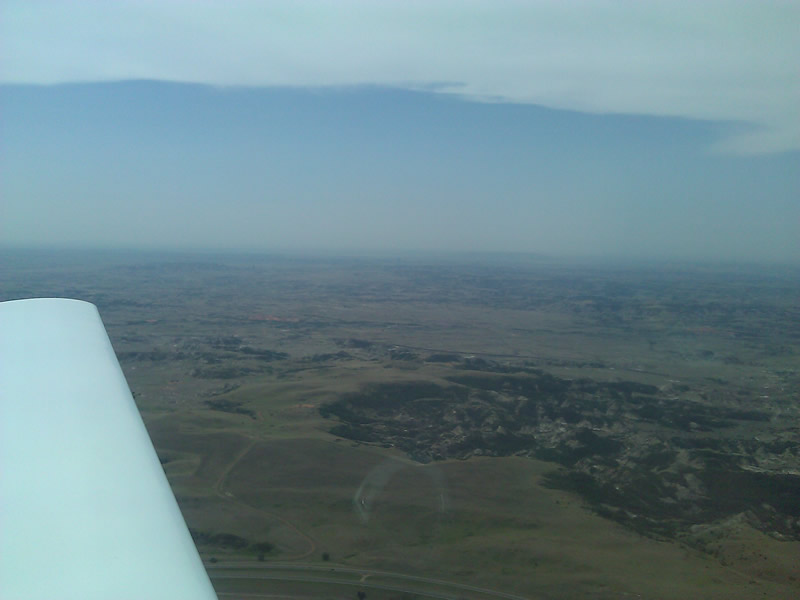
AM departure from KDEW (Deer Park, WA) on Day 1 of trip to Michigan, August 1, 2012.
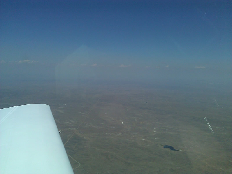
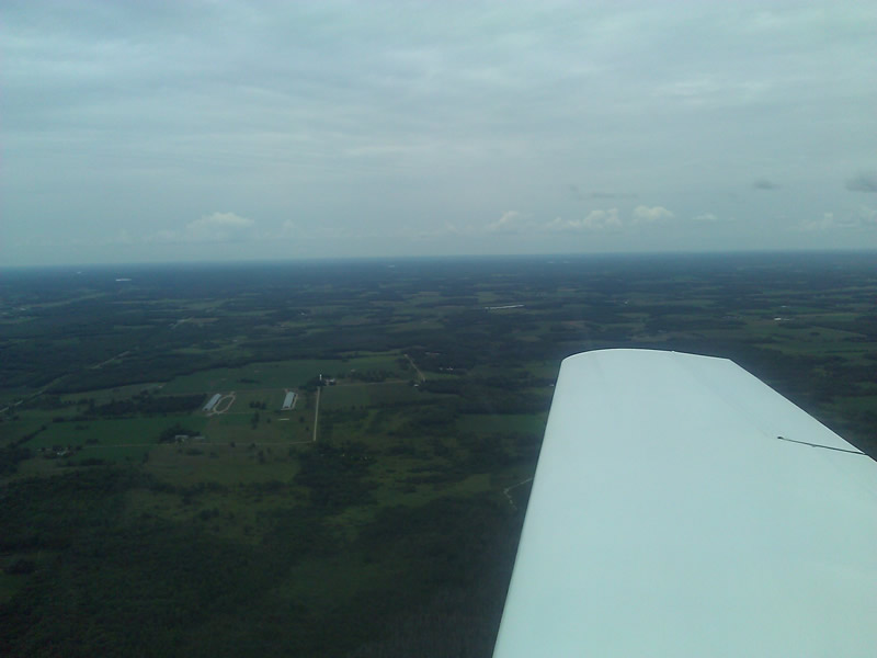
About 30 miles east of COE (Coeur d'Alene, ID).
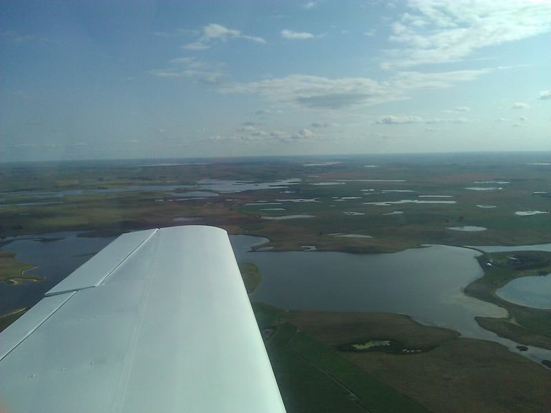
Same location looking north.
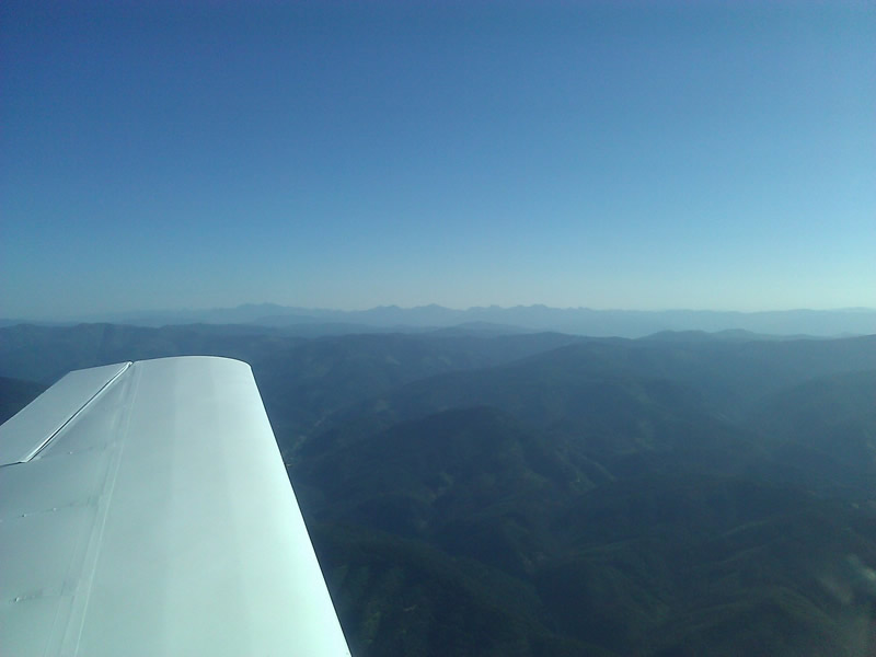
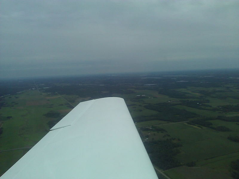
A little further along....
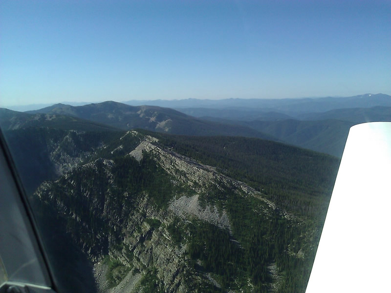
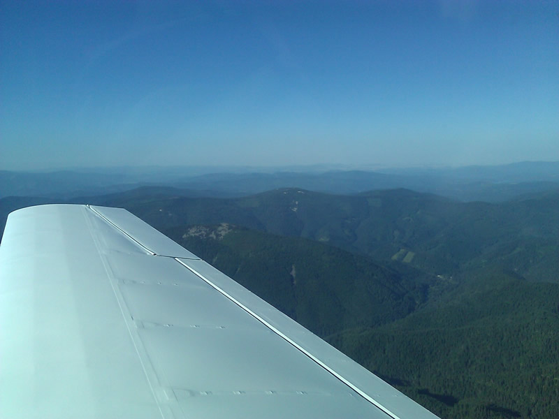
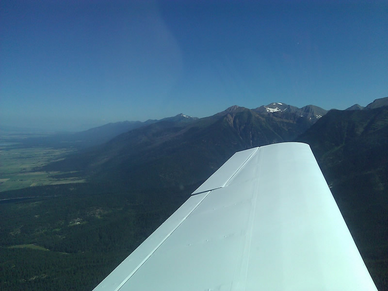
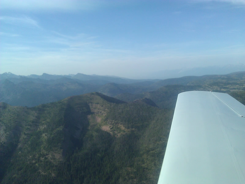
Still at 7500' about half way to St. Ignatius, MT (52S).
52S is in the valley near the base of that mountain.
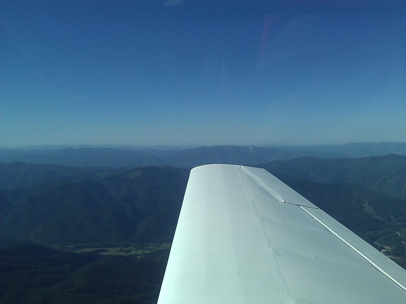
Another near 52S.
Climbing out of 52S enroute to Roundup, MT (RPX).
Still climbing....
And still climbing.... I flew this leg at 11,500' in order to take advantage of 15-20 knot tailwinds.
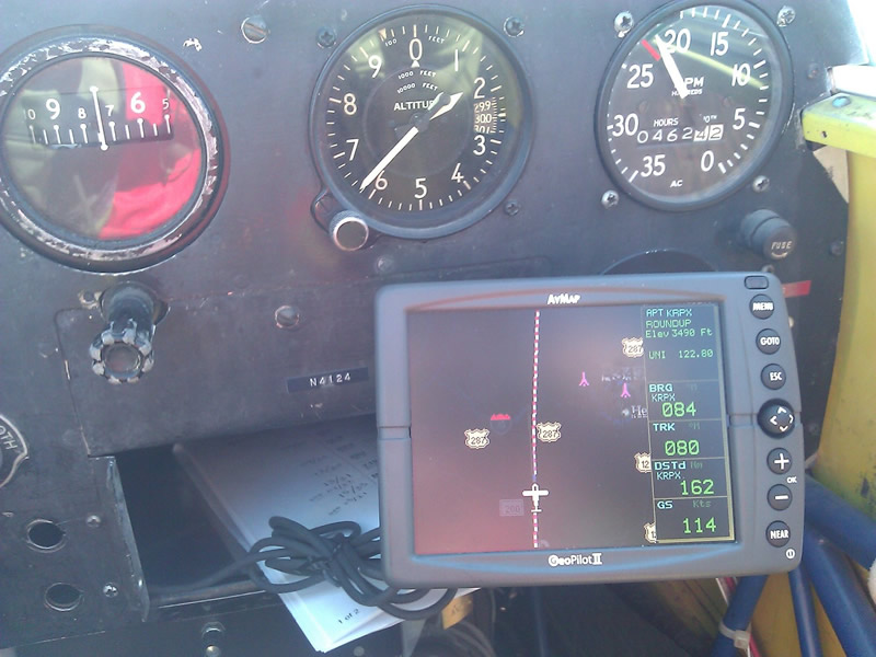
11.5k and 114kts
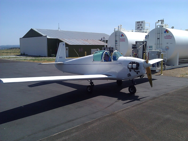
At the fuel pump in Roundup, MT (RPX).
No more mountains, obviously.

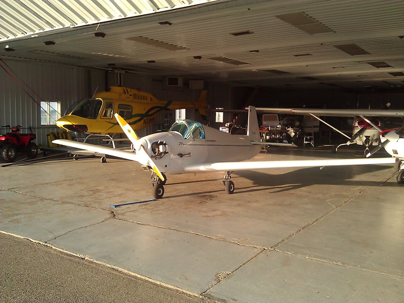
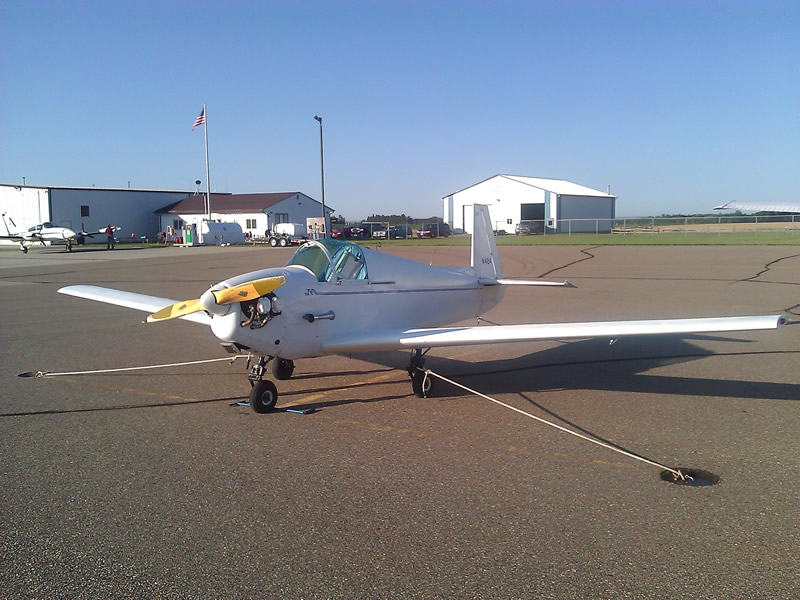
A prime piece of hangar real estate if you fly out of RPX!
All fueled and ready for the next leg to Beach, ND (20U).
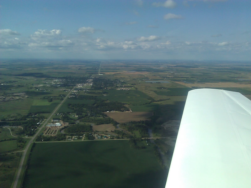
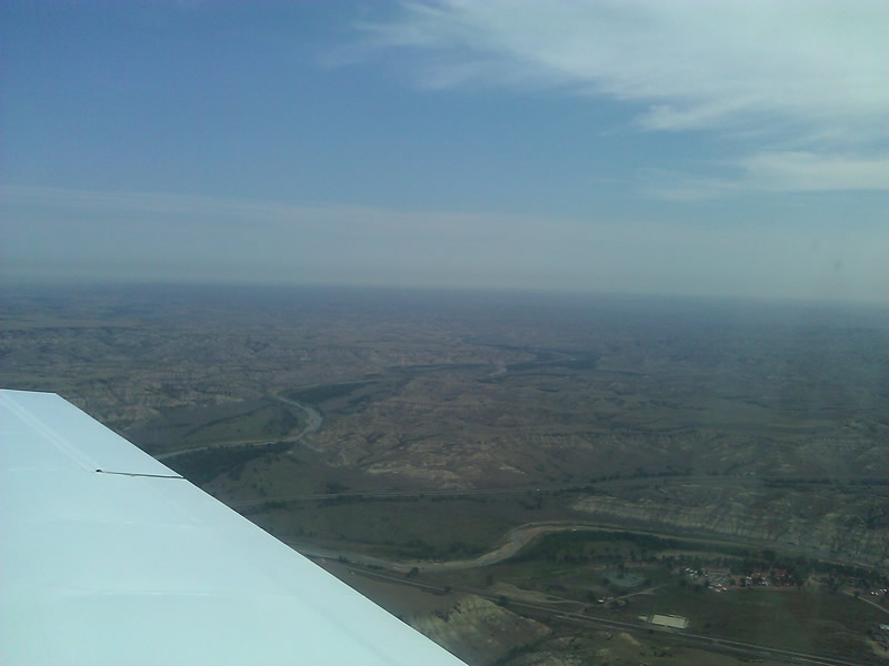
Somewhere northwest of Miles City, MT.

Looking north toward Glendive, MT.

Same location looking south.
Waking up on Day 2 in Mandan, ND (Y19).

Fuel stop in Little Falls, MN (LXL).

Eastern Minnesota.
Dividing line between Minnesota and Wisconsin.
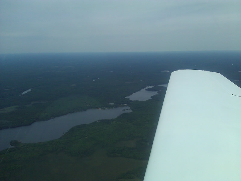
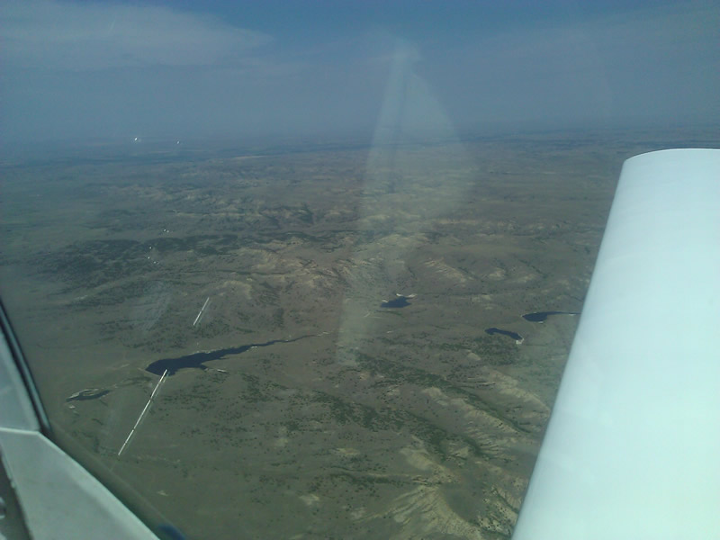
Lakes of Northern Wisconsin.
Fuel stop in Phillips, WI (PBH).

Best fuel prices the entire trip, including Mogas which I used.
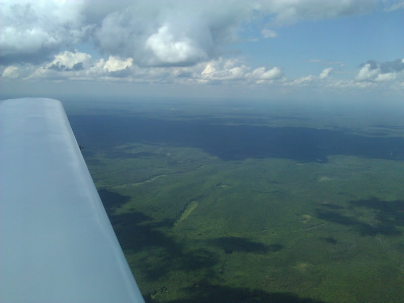
North-central Wisconsin has a lot of unblemished wilderness.
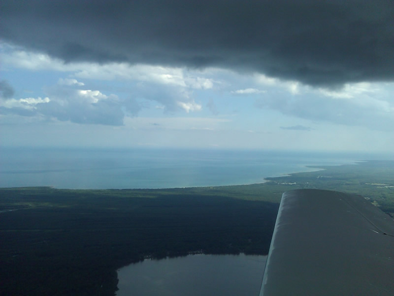
Thunderstorms.
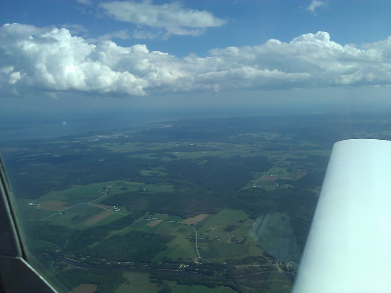
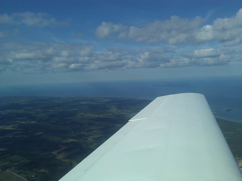
Finally the Upper Peninsula of Michigan. Escanaba with the Lake Michigan shoreline in the distance.
Under the thunder cell looking north.
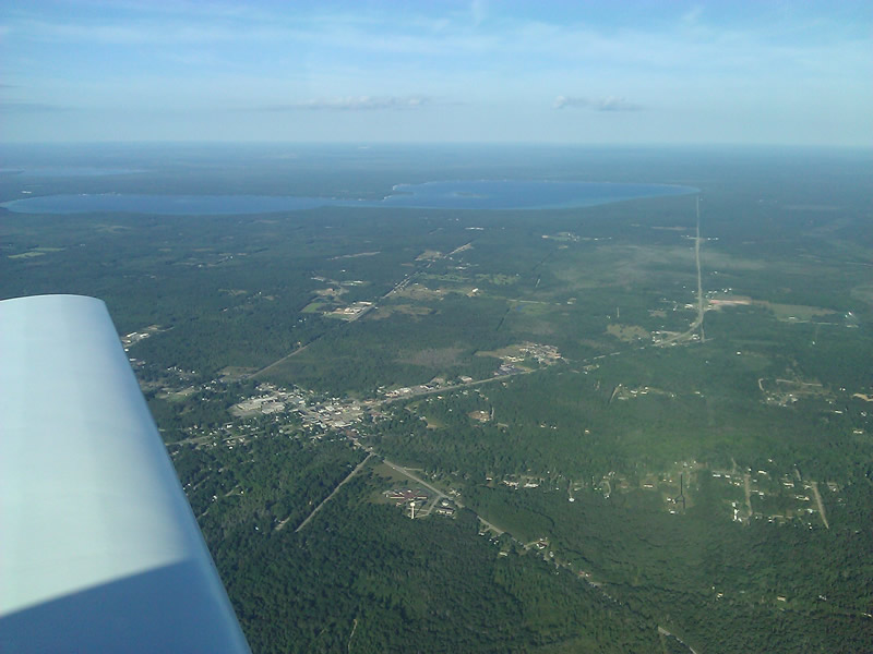
Manistique airport (Schoolcraft County) (ISQ) was about 8 miles off the nose.

Schoolcraft County airport (Manistique, MI) off the nose thru the prop blades.
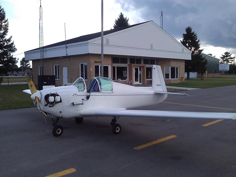
Fueling in Manistique was unique.... They have the honor system here. No payment needed. Fuel your aircraft, fill out a slip and they will bill you. No credit cards.
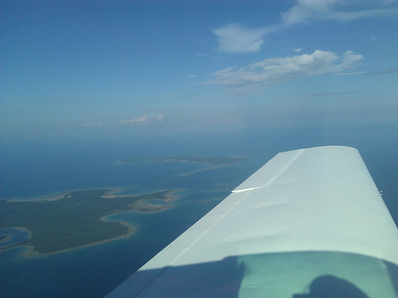
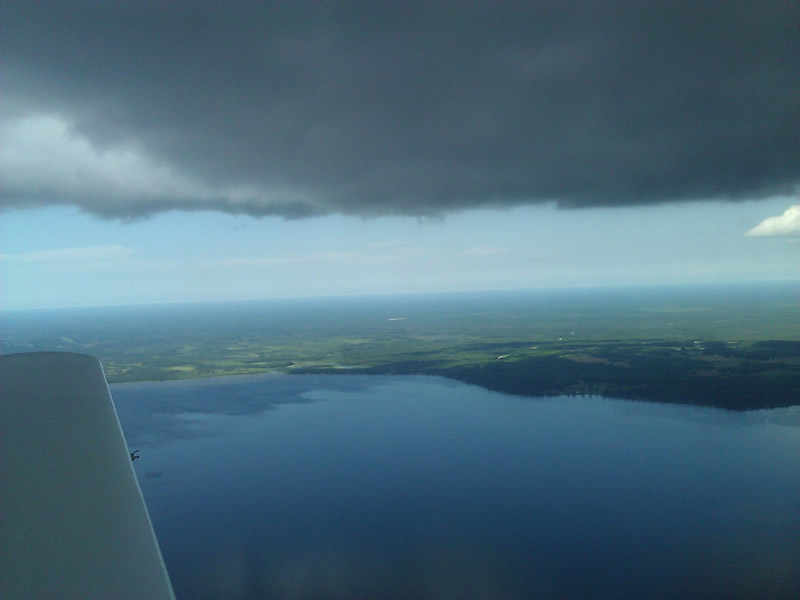
Crossing Lake Michigan over Beaver Island area.
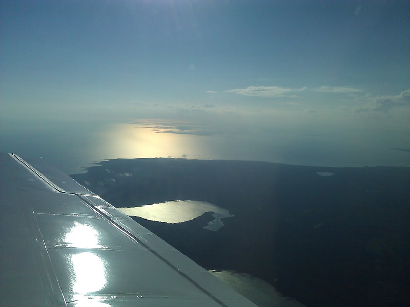
Beaver Island.
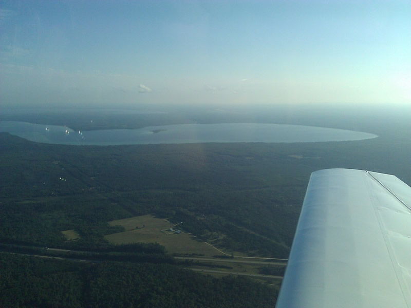
Higgins Lake, MI.
One of the cool things about flying the Mite is, every fuel stop I made, the fuel I added never broke into double digits! In Wahpeton, ND I only took on 3 gallons. It was mostly a rest stop to dump morning coffee.
Return Trip
I departed St. Helen, MI around 8:30 AM on Sunday 8/12/12 and set course for Charlevoix as my shoreline target to overfly enroute to my first fuel stop across the lake at Manistique (ISQ – Schoolcraft County Airport) in the Upper Penisula.
I crossed Beaver Island at about 4500’ and was in a race with a Glasair to get in the pattern at ISQ. He obviously won, but told me on the ground that it seemed strange to him to be “running away from a Mooney so fast” until he took a closer look and realized it was no standard Mooney.
Soon after we landed, a Corbin Baby Ace entered the pattern and taxied in. One of the guys in the Glasair was meeting the Baby Ace owner at ISQ to purchase the Ace and fly it back to Central Wisconsin where he was from. It was a great looking little homebuilt. I actually owned a Lycoming (0-145-B2) Baby Ace for a few years back in the mid-90’s and it was a fun little open cockpit airplane.
Higgins Lake.
Grand Traverse Bay.

Beaver Island, MI.

Corbin Baby Ace at ISQ (Manistique, MI).
From ISQ across Upper Peninsula to Phillips (Price County) Wisconsin.
No weather concerns this leg. Smooth air at 4500’ and maybe a 10 knot headwind. Took on 7.5 gals of Mogas at Price County at $4.13/gal for a whopping total of $30.98 this fuel stop.
Next stop Little Falls, MN (LXL).

Iron Mountain Airport.
Lakes of Northern Wisconsin.
Fuel stop 2 at Phillips, WI.
Across northern Wisconsin into Minnesota.
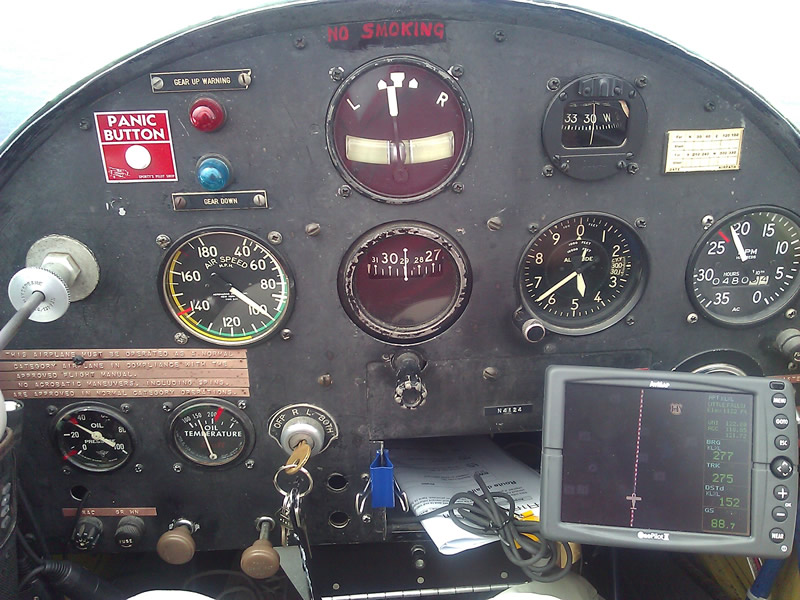
Soon after departing Phillips, as the panel shot shows, I am 152 miles out from LXL at 4600’ making 88.7 KTS ground speed. St. Croix River is the dividing line between WI and MN. Little Falls, MN has always had reasonable 100LL prices for the past 15 or so years that I have been stopping in there. This time was no different. I took on 8 gallons at $4.94/gal for a total of $40.00.

St. Croix River, Wisconsin and Minnesota.
Little Falls, MN (LXL), fuel stop 3.
A short hop to Wahpeton, North Dakota.
From LXL, I flew a short hop to Wahpeton, ND (I believe it was about 95 miles) just south of Fargo and barely inside the ND line. Their gas is spendy ($5.94/gal 100LL) but there was no other fuel stop along my course line from there to Mandan (Y19) so I took on 4 gallons at Wahpeton ($23.94).
Before I left, a guy pulled in to look at the airplane. Had seen me in the pattern and didn’t know what it was so came to check it out. Mites seem to attract curiosity seekers, as we all know ....
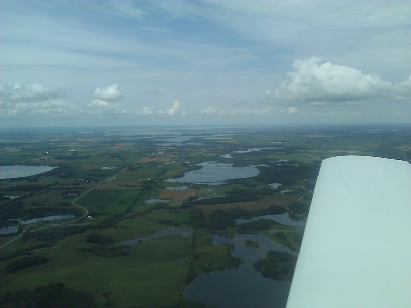
Minnesota farm country.
Minnesota lakes.

Wahpeton to Mandan (Y19) to finish Day 1.
Lost some of my headwind this leg due to high pressure that was sitting up in Canada that finally gave me a bit of a quartering tailwind, or at the very least no impact. This was one of the longer legs that was close to 180 miles I believe – half the length of ND. I finished the day with 9.5 hours in the saddle so it felt really good to tie it down and find a hotel.
Mandan (Y19) is a sleepy little airport right across the river from busier Bismark, but they have always had reasonable gas prices and have a couple of courtesy cars,and nice bathroom facility complete with a shower. Good place to stop for fuel, a rest or an overnight.
North Dakota lakes.
Farm country near Lisbon, ND.
Mandan, ND overnight on the return trip.
Day 2 of Return Trip from MI to WA. First Leg: Mandan to Beach, ND
Monday morning August 13 in Mandan, ND. Filled up with 9.6 gals of 100LL at $5.00/gal.
I recently read a couple different biographies on Teddy Roosevelt and learned that sometime in the 1880’s he purchased a ranch near Medora, ND and spent a lot of time in this area raising cattle and hunting. He shot his one and only bison here at a time when there were probably less than a 3000 animals left on the planet. Later, as President, he was responsible for saving the species by rounding up some remaining animals from the Great Plains and working with the Bronx Zoo to establish a breeding program and re-releasing animals into the wild.
I flew directly over Medora and snapped some shots of Teddy’s old stomping grounds.
Looking south near Medora, ND.

Badlands near Medora, ND.

North Dakota Badlands.
Beyond Medora and the Theodore Roosevelt National Park, the Badlands melt into the Golden Valley and beautiful farm country before crossing the state line into Eastern Montana. Beach, ND practically straddles the state line and is my first fuel stop on my 2nd Day of the return trip to Washington.

Little Missouri River south of Medora, ND.

Looking south on descent to Beach, ND.

Interstate highway I94 and farmland near Beach, ND.
Fuel Stop at Beach ND.
Forgot the attached pic of the Park looking Northwest from directly over Medora before descending into Beach.
Picked up 5.5 gals at Beach at $5.60 per gal for a total of $30.80. I was greeted there by a very affectionate little cat who came straight up to me and stoked my legs and rolled over at my feet.
Next stop was supposed to be Roundup, MT, but I was in for a surprise . . . .

Teddy Roosevelt National Park.

Very affectionate airport cat at Beach, ND.

Fuel stop 1 on Day 2 (on the return trip), in Beach, ND.
Enroute to Roundup, MT
The leg through Eastern Montana is always the most grueling when taking this trip because the terrain resembles a moonscape and the ride is usually bumpy because I’m passing through during late morning or early afternoon when everything is starting to heat up and thermals are being created. Also, there is hardly a plant growing other than sagebrush to squelch any winds. To find a cool, smooth ride you usually have to climb to a higher altitude, but then you can easily be bucking a 20 knot headwind. No joy any way you look at it out here. If you have to put it down, though, you better know how to build a solar still.
My fuel stop was supposed to be Roundup with $4.95/gal 100LL but as I approached the airport I noticed large X’s placed over the runway numbers and heavy equipment operating near the west end of the airport so I was forced to pick an alternate. Harlowton is the next airport about 45 miles West, but no services. I had about 7 gals of fuel left so could still fly an hour and a half before running dry. I headed to Harlowton (HWQ) and was overhead in about 35 mins. Runways at HWQ are 8/26 and, unfortunately for me, the wind was blowing from about 350@15 and gusting to 20. I was able to get the Mite on the ground by landing it like it was an Ercoupe, but now had to find fuel and worry about having enough crosswind authority to take off without clipping any runway lights.
A County Road Commission garage was located right across the street from the airport so I walked over and explained my dilemma to a manager named Steve who grabbed two 5 gal gas cans and told me to get in his truck and we headed downtown for some auto gas. A brush fire had broken out SW of town and Steve continued to bark instructions over a radio in his truck to his employees who were working it. For him to make time to help me made me feel very fortunate. I added just enough fuel to get me to Helena about 100 miles to the West because the temperature was in the 90’s, taking HWQ’s 4311’ elevation up to about 6300’ density altitude and I knew at that elevation and with a direct crosswind, I would likely be stuck to the runway for a while. My goal was to lift off as soon as possible and crab it into the wind so I rolled in about 1/3 to 1/2 flaps for take-off and it worked. I was in the air by mid field, crabbing into the wind and clamoring for every foot of altitude I could get.
Throughout all of this I totally forgot about documenting anything with pictures, so I have nothing to back any of this up. One thing I did do before departing HWQ was call 1-800-WXBRIEF and get a standard briefing for the rest of the trip – including NOTAMS!! I had not called before departing Mandan that morning because my main concern was for the weather and I have about six different apps on my Smartphone that feed me all the real time and forecast info I could ever ask for and I knew that I was in the clear all the way home. I won’t be that complacent again.
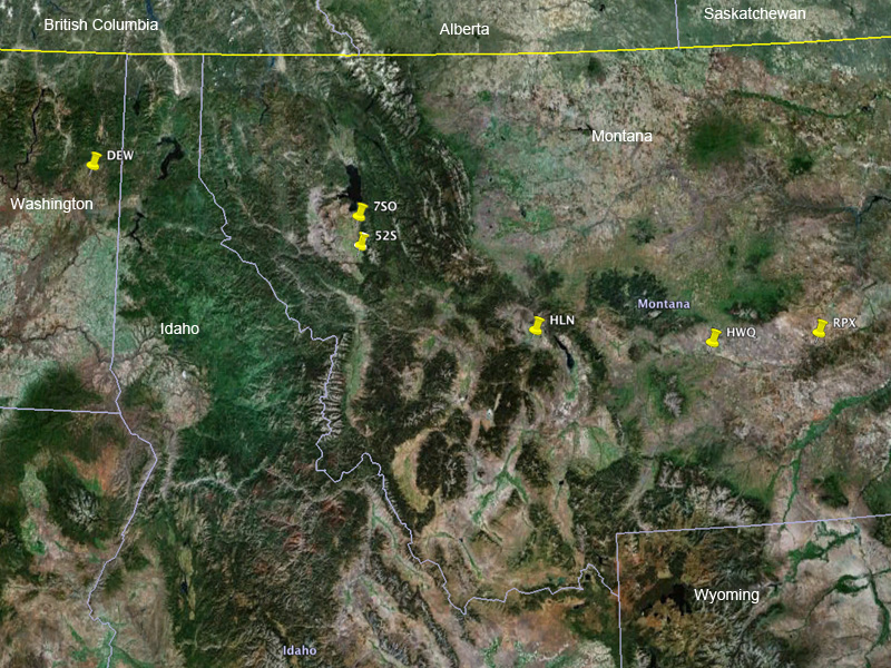
Next – final two legs from Helena to Ronan, MT and home to DEW.

Yellowstone River in eastern Montana.
Desolate terrain in eastern Montana.
Helena to Ronan, MT
The flight from Harlowton to Helena was relatively routine. By now it was midafternoon and the air was hot, bumpy and increasingly hazy from several fires burning in the mountains and feeding smoke into the atmosphere. Refueled at Beck’s U-Pump and continued west knowing that with one more fuel stop I would finally be on my last leg and home. I had refueled at St. Ignatius (52S) on the way out, but knowing the temps in the Flathead Valley were hovering close to 100 degrees made the runway length of 2600’ at 52S seem a bit paltry. I wanted a full 15 gallons to get over the last range of mountains and all the way home so decided on Ronan, MT as my final fuel stop with a 4800’ runway.
As I passed Lincoln, MT west of Helena, I noticed at least two fires burning high in the mountains to the north of me (approximately Scapegoat Wilderness Area). I don’t think they were being worked by anyone as I doubt if any human property was at risk that high up, but with the wind blowing like it was, they were surely spreading fast.
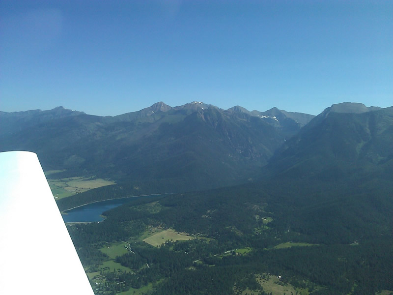
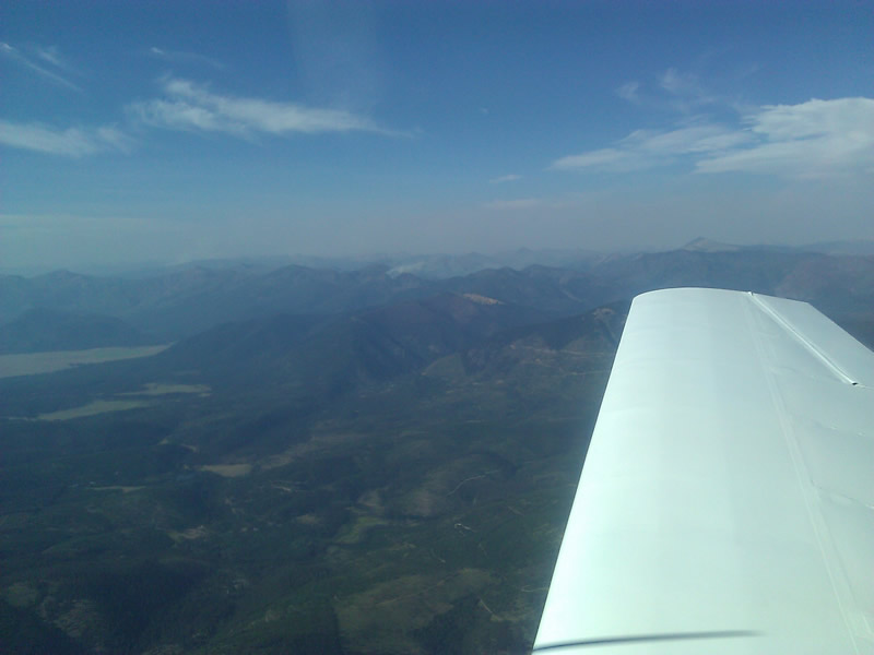
The scenery in the Mission Mountains area north and east of MSO (Missoula, MT) was astounding.
Fire burning in Scapegoat Wilderness area west of Lincoln, MT.
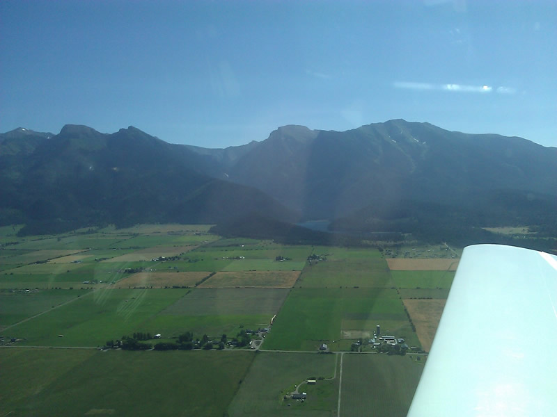
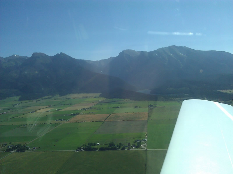
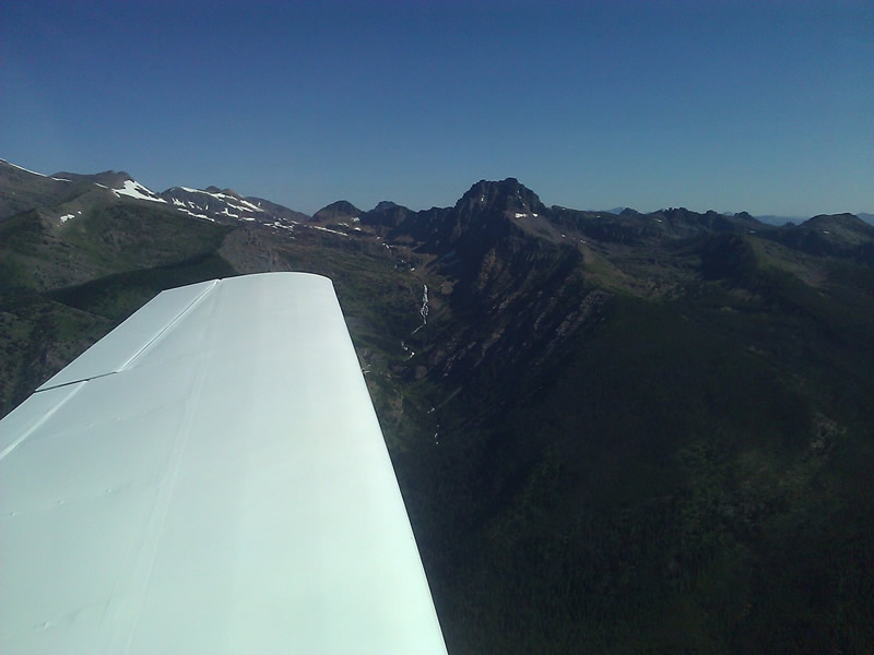
Mission Mountains on descent into Flathead Valley.

Mission Mountains.
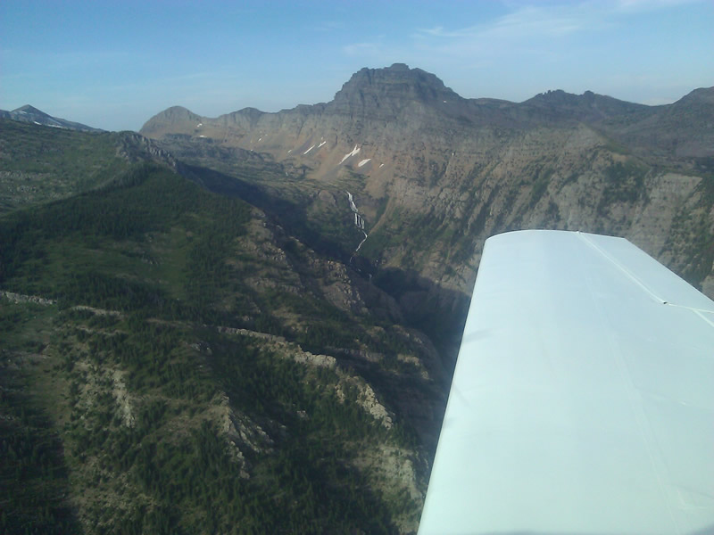
Cascading water in Mission Mountains.
Rattlesnake Wilderness looking towards MSO (Missoula, MT).
Descent into Ronan Continued....
Descending into the Flathead Valley and looking East into the Mission Mountains. The south end of the Bob Marshall Wilderness Area begins here in these mountains and extends north to Kalispell and Glacier National Park.
Final Leg Next!
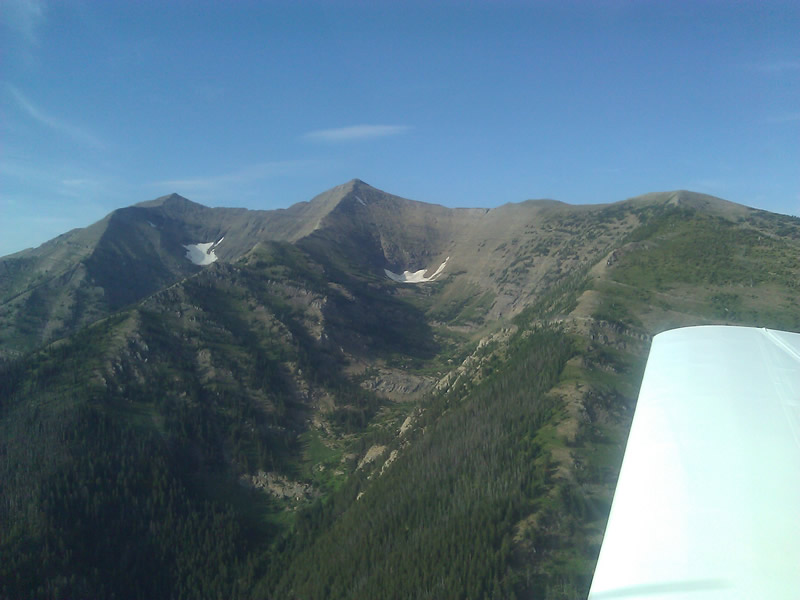
Snow remnants in Mission Mountains.

Waterfall on descent into Ronan, MT (7SO).
Final Leg - Ronan, MT to Deer Park, WA
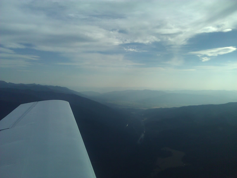
It was about 138 nautical miles direct from Ronan to DEW and I knew I could fly it direct at 8500’ with slight course adjustments to fly through the saddles and avoid peaks on a couple of the ridgelines. This course would also have me overflying several airstrips and coming within gliding distance of a couple more. The headwind was unforgiving at altitude – probably 20+ knots. I had an ETA at DEW of 7:30PM and the sun was directly off the nose the entire way. The smoke and haze meant everything in front of the airplane simply looked like a hazy silhouette with the sun filtering through it. Looking out the sides and behind afforded a clearer view.
Total flight time Day 2 was same as Day 1 at 9.5 hours.

Bucking headwinds 100 miles from home.

On the final leg, smoke and haze in the Bitterroot Range.

Final leg, smoke and haze in the Cabinet Mountains, August 13, 2012.
TRIP SUMMARY
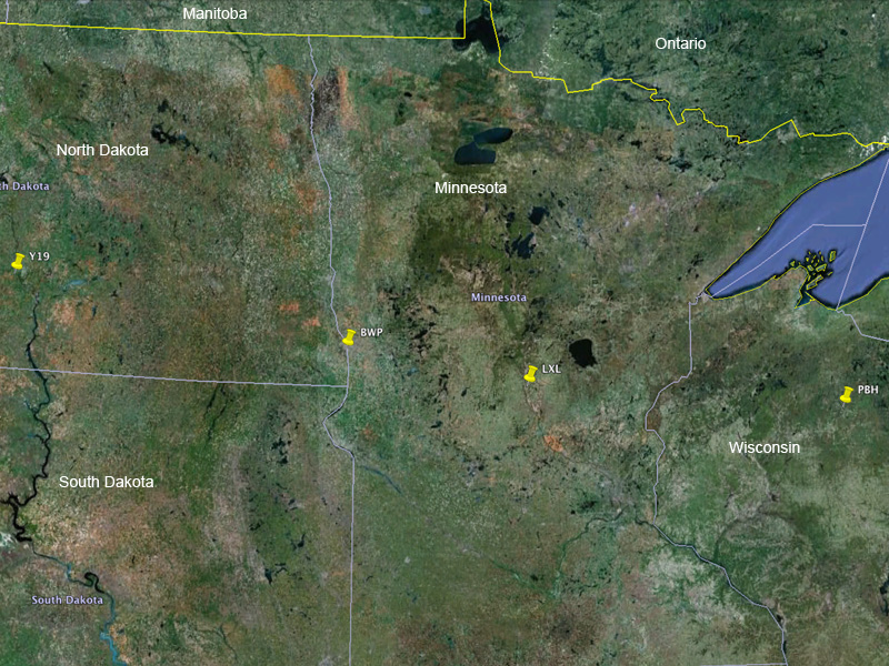
Outbound flight route:
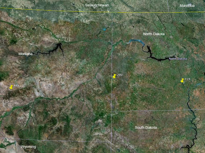
Day 1 (8/1/12): DEW >52S >RPX >20U >Y19
[Deer Park, WA - St Ignatius, MT - Roundup, MT - Beach, ND - Mandan, ND]
Day 2 (8/2/12): Y19 >BWP >LXL >PBH >ISQ >6Y6
[Mandan, ND - Wahpeton, ND - Little Falls, MN - Phillips, WI - Manistique, MI - St Helen, MI]Total distance outbound: 1431 NM
Total flight time to Michigan: 8.1 + 8.5 = 16.6 hours
Gals of fuel to get to Michigan: 60.2 gals
Burn Rate: 3.63 gals/hr
Economy: 23.8MPG
Total fuel cost DEW > 6Y6: $302.75
Average price per gal: $5.03
Return trip flight route:
Day 1 (8/12/12): 6Y6 >ISQ >PBH >LXL >BWP >Y19
[St Helen, MI - Manistique, MI - Phillips, WI - Little Falls, MN - Beach, ND - Wahpeton, ND - Mandan, ND]
Day 2 (8/13/12): Y19 >20U >HWQ >HLN >7S0 >DEW
[Mandan, ND - Beach, ND - Harlowton, MT - Helena, MT - Ronan, MT -Deer Park, WA]Total distance return trip: 1445 NM
Total flight time back to Washington: 9.5 + 9.5 = 19 hours
Estimated Gals of fuel return trip: 72.2 gals
Burn Rate: 3.8 gals/hr
Economy: 20MPG
Return numbers are going to be ballparkish because I don’t have receipts for the auto gas in Harlowton or in Helena as the pumps were out of printer paper. Won’t know total fuel cost on return trip until I get my credit card bill.
Thanks for sharing this trip with me, Dave!
And thanks to you, Joel, for going to all the trouble of sending us the photos and words.
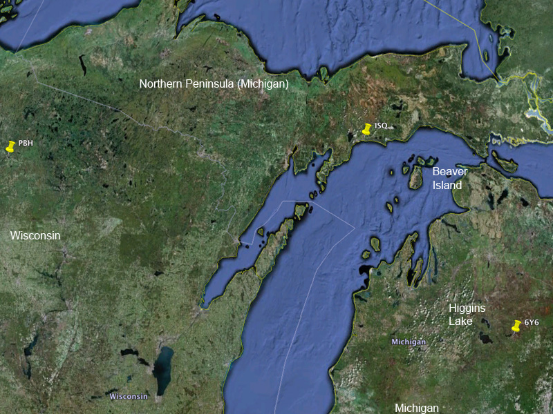
Maps courtesy of Google
2012-08-17